


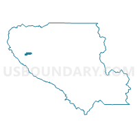
Voting District 53560, Santa Clara County, California
About
Outline

Summary
| Unique Area Identifier | 543849 |
| Name | Voting District 53560 |
| County | Santa Clara County |
| State | California |
| Area (square miles) | 1.96 |
| Land Area (square miles) | 1.96 |
| Water Area (square miles) | 0.00 |
| % of Land Area | 100.00 |
| % of Water Area | 0.00 |
| Latitude of the Internal Point | 37.28696910 |
| Longtitude of the Internal Point | -122.03414450 |
Maps

Graphs
Select a template below for downloading or customizing gragh for Voting District 53560, Santa Clara County, California


Neighbors
Neighoring Voting District (by Name) Neighboring Voting District on the Map
- Voting District 53075, Santa Clara County, CA
- Voting District 53285, Santa Clara County, CA
- Voting District 53290, Santa Clara County, CA
- Voting District 53295, Santa Clara County, CA
- Voting District 53525, Santa Clara County, CA
- Voting District 53555, Santa Clara County, CA
- Voting District 53570, Santa Clara County, CA
- Voting District 53585, Santa Clara County, CA
- Voting District 53595, Santa Clara County, CA
- Voting District 53620, Santa Clara County, CA
- Voting District 53645, Santa Clara County, CA
Top 10 Neighboring County Subdivision (by Population) Neighboring County Subdivision on the Map
Top 10 Neighboring Place (by Population) Neighboring Place on the Map
Top 10 Neighboring Elementary School District (by Population) Neighboring Elementary School District on the Map
- Cupertino Union Elementary School District, CA (138,600)
- Moreland Elementary School District, CA (47,625)
- Saratoga Union Elementary School District, CA (19,679)
Top 10 Neighboring Secondary School District (by Population) Neighboring Secondary School District on the Map
- Fremont Union High School District, CA (223,745)
- Campbell Union High School District, CA (220,303)
- Los Gatos-Saratoga Joint Union School District, CA (53,209)
Top 10 Neighboring State Legislative District Lower Chamber (by Population) Neighboring State Legislative District Lower Chamber on the Map
- Assembly District 22, CA (463,391)
- Assembly District 24, CA (442,181)
- Assembly District 21, CA (432,366)
Top 10 Neighboring State Legislative District Upper Chamber (by Population) Neighboring State Legislative District Upper Chamber on the Map
Top 10 Neighboring 111th Congressional District (by Population) Neighboring 111th Congressional District on the Map
Top 10 Neighboring Census Tract (by Population) Neighboring Census Tract on the Map
- Census Tract 5077.02, Santa Clara County, CA (6,126)
- Census Tract 5075, Santa Clara County, CA (5,810)
- Census Tract 5079.05, Santa Clara County, CA (5,784)
- Census Tract 5074.01, Santa Clara County, CA (5,624)
- Census Tract 5076, Santa Clara County, CA (5,563)
- Census Tract 5078.08, Santa Clara County, CA (5,508)
- Census Tract 5079.03, Santa Clara County, CA (4,828)
- Census Tract 5079.06, Santa Clara County, CA (4,460)
- Census Tract 5074.02, Santa Clara County, CA (3,881)
- Census Tract 5079.04, Santa Clara County, CA (3,367)